


Lima Labs — More valuable crops. Less uncertainty.

Scan every field todetect issues.

AI monitoring for field and greenhouse growers. Better crop health, on-point decisions and harvest forecasts your sales team can sell against.

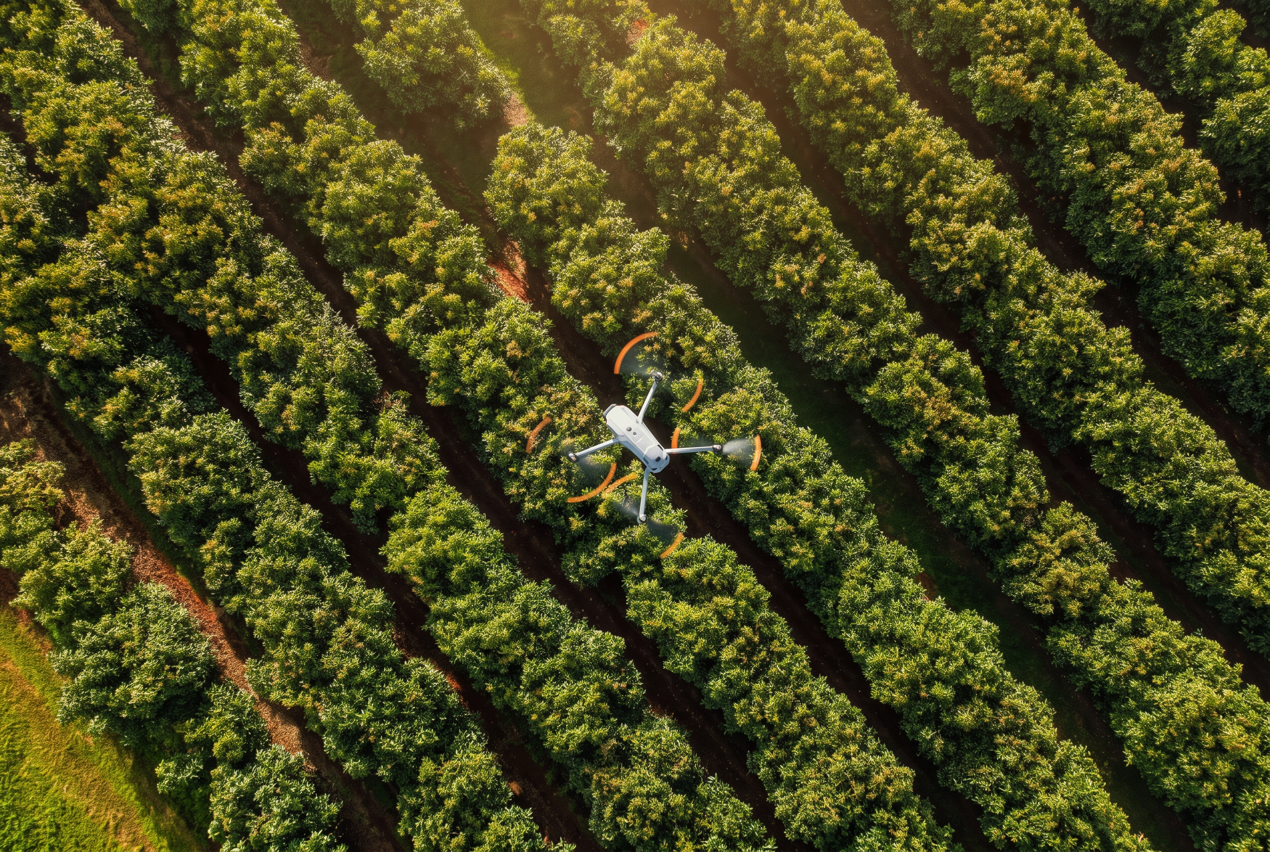
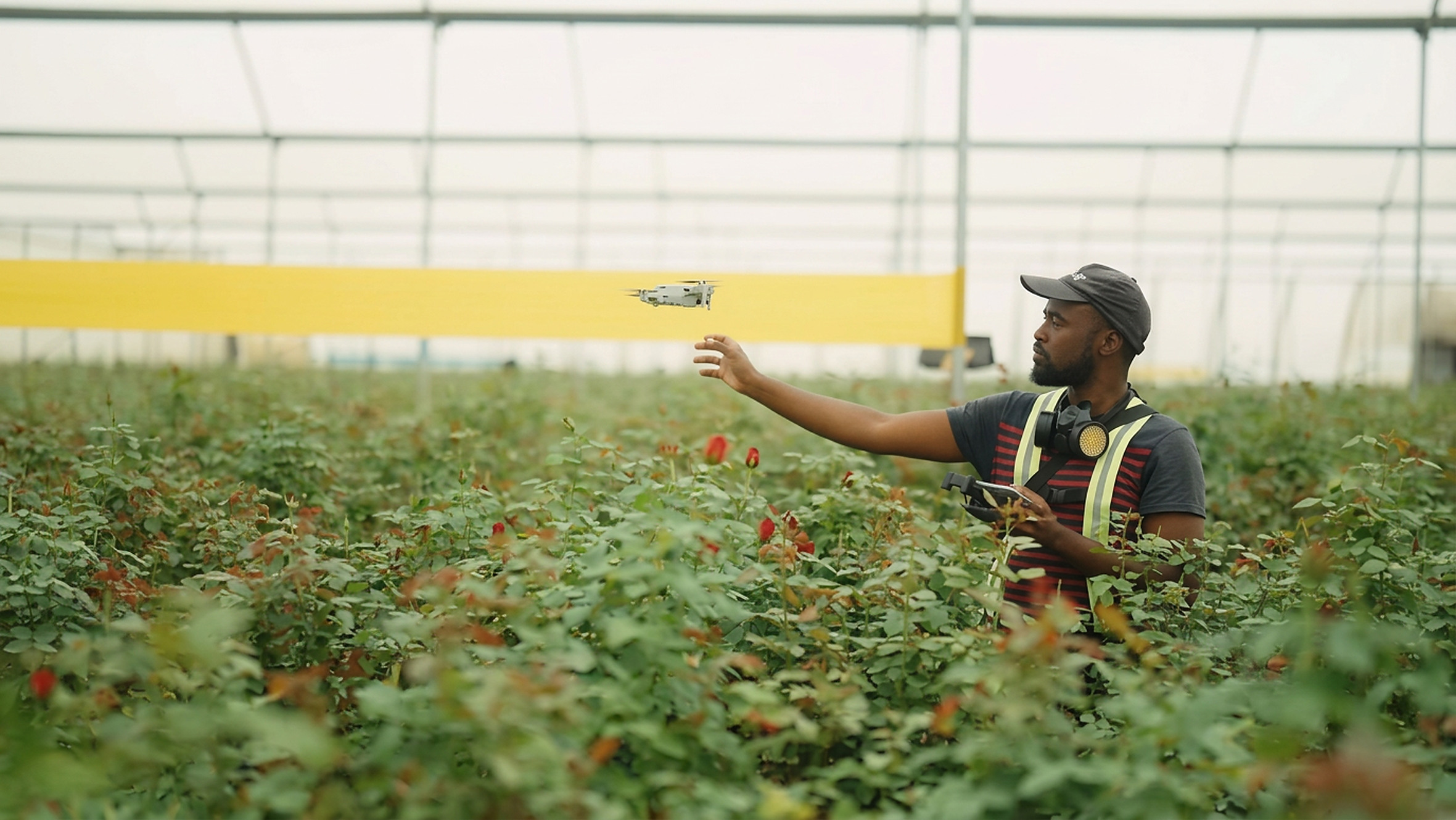
Aerial view over rows of an orchard in warm evening lightGrower releasing a small drone over cut flower rows inside a greenhouse

Industry leading partners

NVIDIA Inception Program
AWS
Kenya Climate Innovation Center
TechCrunch
Chrysal
Mount Elgon Orchards
ALX
AAA Growers
Marginpar
Rift Valley Roses
NVIDIA Inception Program
AWS
Kenya Climate Innovation Center
TechCrunch
Chrysal
Mount Elgon Orchards
ALX
AAA Growers
Marginpar
Rift Valley Roses

“When scouting relies on spot-checks and clipboards, farm managers spend the whole season firefighting instead of optimizing.”

By the time you spot plant stress, or see an unexpected flush, you're already too late.

01

The scouting blind spot

A scout walking a couple of rows with a clipboard covers less than 2% of the canopy or bed area each week. Mites, root rot and irrigation leaks build quietly in the middle of a block — costing 10% to 25% in grade downgrades and yield loss before anything is visible from the field.

02

Harvest and sales guesswork

Volumes are committed to retailers and packhouses weeks ahead on eyeball estimates and thin manual sampling — a ±20% to 30% forecast error that means a glut sold at salvage prices, or a shortfall with short-delivery penalties and a damaged customer relationship.

03

The blanket spray trap

Without exact hotspot coordinates, the safe call is always to spray the whole field or greenhouse bay — so 30% to 40% of inputs land on crop that was healthy, burning budget and stressing plants. More spray means less quality.

Our solutions

See every block in one view

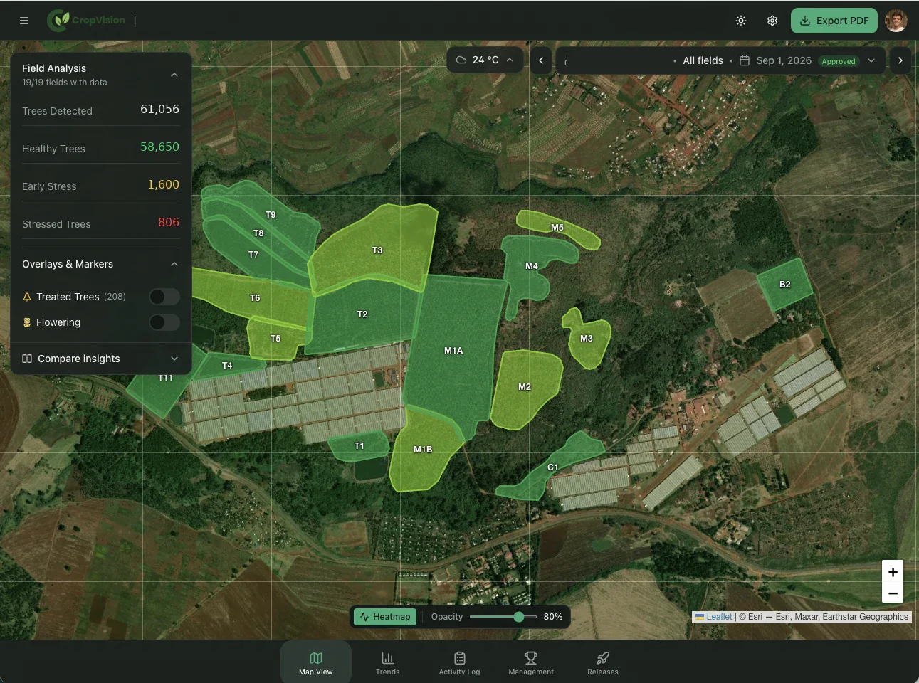
Indoors and out, Lima turns drone and sensor data into an interactive map: stem density, tree counts, stress zones and flowering blocks — all visible at a glance.

Fruit trees

Outdoor · CropVision

CropVision orchard map showing tree counts, stress zones and block boundaries over aerial imagery

Fruit trees · CropVision

Current product scope

Outcomes

  • Less time spent scouting and reporting in the field
  • Greater accountability with every field task assigned, tracked and verified
  • 5–20% fewer stressed trees through earlier detection and intervention
  • Fewer trees lost by identifying Phytophthora and root rot risks sooner
  • Higher fruit set through spray schedules timed to flowering
  • More accurate harvest forecasts using flowering and tree-level health data

Choose how you want to start

Pay annually for a 15% discount
Smart Manager

€5

per user
Smart Farmer

€180

/ha/year
Commercial Farm Operations

€300

/ha/year

Web App

Smart Manager: true
Smart Farmer: true
Commercial Farm Operations: true

Mobile App

Smart Manager: true
Smart Farmer: true
Commercial Farm Operations: true

Field actions tracking

Smart Manager: true
Smart Farmer: true
Commercial Farm Operations: true

Task allocation

Smart Manager: true
Smart Farmer: true
Commercial Farm Operations: true

Monitoring team productivity

Smart Manager: true
Smart Farmer: true
Commercial Farm Operations: true

Multispectral drones

Smart Manager: not included
6 flights
12 flights

Tree health monitoring

Smart Manager: not included
Smart Farmer: true
Commercial Farm Operations: true

Tree flowering

Smart Manager: not included
Smart Farmer: not included
Commercial Farm Operations: true

Tree-level insights

Smart Manager: not included
Smart Farmer: true
Commercial Farm Operations: true

Task verification

Smart Manager: not included
Smart Farmer: true
Commercial Farm Operations: true

Farm memory insights

Smart Manager: not included
Smart Farmer: true
Commercial Farm Operations: true

Weather sensors

Additional cost
Additional cost
Additional cost

How it works

Collect data and know what is happening in the field.

The new farming Field Management System to turn aerial imagery into verified field action, then learns from every action and result.

  1. Drone capture

    Data capture
  2. Upload & image processing

  3. AI analysis

  4. Reporting & mapping

  5. Task allocation & verification

  6. Business insights

Farm memory for continuous learning

Results feed back into the next analysis cycle.

Adoption built around how you already work.

Insights land where your team already is — TV screens in the pack house, WhatsApp, mobile, desktop or straight into your ERP.

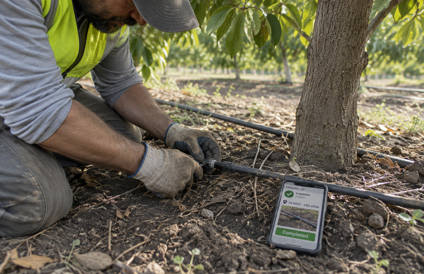
A field worker completing a geo-tagged irrigation repair task on a phone beside a tree
  1. Step 1

    We learn about your farm

    Crops and varieties, operational setup, teams and challenges. Drones, your existing data and simple field checks give us a baseline from day one.

  2. Step 2

    We set up Lima Labs tools

    We connect your farm to our system and handle the drone flights, AI forecasts and dashboards — clear reports without extra work for your team. We are on the farm with you.

  3. Step 3

    You get ongoing support

    Regular updates and insights that help you plan harvests, cut waste and make better decisions every week.

Plan your next season
with confidence.

Bring your fields. We'll bring the data. Book a demo and we'll walk your farm, fly a first baseline and show you what the forecast would have told you last season.

Pilots
Open for the 2026 season

First available flight is 3 weeks from today.

Your request goes straight to our team at info@lima.ag.